World University & School News and Q & A Live Hangout on Air
https://www.youtube.com/WorldUnivandSch
Mon, Oct 22 2018, 10 am PT, 5pm UTC/GMT
Topic: Your Ideas, Questions, Thoughts & Focusing Hangouts
~ https://wiki.worlduniversityandschool.org/wiki/Nation_States ~
The Hangout is hosted by Scott MacLeod
~ http://worlduniversityandschool.org ~
*
World Univ & Sch's Live Hangout on Air 10.22.18: A) Actual-Virtual Lego Robotics & B) Twin Studies, both in a Realistic Virtual Earth https://youtu.be/RJGEeU0Eo5c A) https://wiki.worlduniversityandschool.org/wiki/Robotics & B) https://wiki.worlduniversityandschool.org/wiki/Twin_Studies > #RealisticVirtualEarthForLego & #RealisticVirtualEarthForCRISPR ~
- https://twitter.com/WorldUnivAndSch/status/1054424644063645696 -
World Univ & Sch's Live Hangout on Air 10.22.18: A) Actual-Virtual Lego Robotics & B) Twin Studies, both in a Realistic Virtual Earth https://t.co/Lk8WTAWOxh A) https://t.co/D82CmYOQib & B) https://t.co/yNxMahMQQw > #RealisticVirtualEarthForLego & #RealisticVirtualEarthForCRISPR~— Languages-World Univ (@sgkmacleod) October 22, 2018
- https://twitter.com/sgkmacleod/status/1054426151689441280 -
- https://twitter.com/scottmacleod/status/1054425514817970176 -
*
World Univ & Sch: Actual-Virtual Lego Robotics & Twin Studies in a Realistic Virtual Earth
https://youtu.be/RJGEeU0Eo5c
*
Robots for cleaning https://twitter.com/Soonfeed/status/1054285022075719680 … & which WUaS students can design even in Lego for learning & in a #RealisticVirtualEarth Re #RVE maybe furniture even will change in response to robot cleaners. In conjunction w Stanford, how to become a network excellent manufacturers?
Robots for cleaning https://t.co/6ds13ylwAj & which WUaS students can design even in Lego for learning & in a #RealisticVirtualEarth Re #RVE maybe furniture even will change in response to robot cleaners. In conjunction w Stanford, how to become a network excellent manufacturers?— WorldUnivandSch (@WorldUnivAndSch) October 22, 2018
https://twitter.com/WorldUnivAndSch/status/1054400230462910464
*
🔜 Robots will clean your home. Read more viahttps://t.co/mAB9wQa1FY #robotics #automation pic.twitter.com/TWOvITKJ3q— Soonfeed Media 🇪🇺 (@Soonfeed) October 22, 2018
*
Re this Stanford Robot - https://twitter.com/Stanford/status/1054843010196869121 - am curious if I could code it, with a Stanford class I might be teaching even, to clean my house, as a test case ... and first in Lego scale, with actual Lego's for both actual and virtual Lego robotics in Brick Street View for further problem solving. :)
"Despite persistent optimism, roboticists and A.I. researchers have painfully learned that while computers can run mathematical circles around humans, things that humans do without thinking are the most difficult for machines."
"Despite persistent optimism, roboticists and A.I. researchers have painfully learned that while computers can run mathematical circles around humans, things that humans do without thinking are the most difficult for machines." https://t.co/a2W8A0dBmk— Stanford University (@Stanford) October 23, 2018
https://twitter.com/Stanford/status/1054843010196869121
* *
Re Twin studies:
https://wiki.worlduniversityandschool.org/wiki/Twin_Studies ...
https://en.wikipedia.org/wiki/Twin_study
https://en.wikipedia.org/wiki/Twin_Research_and_Human_Genetics
https://en.wikipedia.org/wiki/Twin
* * *
How might we best develop a #RealisticVirtualEarth, as #RealisticVirtualEarthForGeology for geology & environmental safety+, a #RealisticVirtualEarthForHistory re images - photography, film and video - and maps from different dates & places, and for machine learning image comparison > https://wiki.worlduniversityandschool.org/wiki/Geology_and_Geophysics ?
How might we best develop a #RealisticVirtualEarth, as #RealisticVirtualEarthForGeology for geology & environmental safety+, a #RealisticVirtualEarthForHistory re images and maps from different dates & places, and for machine learning image comparison > https://t.co/eLJauEXb7z ?— WorldUnivandSch (@WorldUnivAndSch) October 22, 2018
https://twitter.com/WorldUnivAndSch/status/1054499979757146112
*
google earth for geology (searched)
#RealisticVirtualEarthForGeology
-https://youtu.be/5x8_4HX0B7k
-https://youtu.be/C7vtxPFIQCk
-https://youtu.be/YD5Tr4PQOWk
-https://mrdata.usgs.gov/geology/state/
-Teaching Geologic Map Interpretation Using Google Earth https://serc.carleton.edu/NAGTWorkshops/structure/teaching_geo_map_interp.html
- http://www.onegeology.org/howto/1_4_6.html ~
google earth for geology (searched)#RealisticVirtualEarthForGeology— WorldUnivandSch (@WorldUnivAndSch) October 22, 2018
-https://t.co/Vug6EHfrRl
-https://t.co/8D8SROu5U9
-https://t.co/QxhJYrAjmv
-https://t.co/Nxo5EZQedC
-Teaching Geologic Map Interpretation Using Google Earth https://t.co/0E3IbHdjnW
- https://t.co/QrQS8uNovQ ~
*
Hi Alan,
Thanks for an interesting talk "ERE Seminar: Alan Burnham, PhD, Stanford University — History and Geology of Livermore Oil"
- https://events.stanford.edu/events/804/80462/.
In seeking to develop a realistic virtual Harbin Hot Springs (my field site) in a realistic virtual earth (for an actual-virtual Harbin Hot Springs' ethnographic comparison, and for geothermal history, for ex.), and in my seeking a position at Stanford, I wonder, hypothetically, how we might explore possibly teaching a class at Stanford together in order to develop a #RealisticVirtualEarth, a #RealisticVirtualEarthForGeology, for oil prospecting even, a #RealisticVirtualEarthForHistory re your images and maps from different dates and places, and for machine learning image comparison, and re Google's TensorFlow (conceptually Google Street View with TIME SLIDER / Maps / Earth / TensorFlow and at the cellular and atomic levels)? I have developing a #RealisticVirtualEarth as STEM field sites in all ~200 countries' official languages, and as classrooms in mind. And could we develop this in this hypothetical Stanford course with the Livermore oil fields in mind as a prototype, and local field site, for modeling this geology and history for the oil research? Or if I were to start teaching a related course in this at Stanford, with students, coders and information technology, could I invite you as a speaker, and could we add your talk, and further address implicit questions in it, for example - with a geology and oil focus (in a specific week)?
I also have a new social method I'm developing which I'm calling STEM ethno-wiki-virtual-world-graphy in mind too - https://scott-macleod.blogspot.com/search/label/ethno-wiki-virtual-world-graphy - which your talk touched on in many ways in your interpreting sociocultural questions around Livermore oil fields at different time periods / dates, for example, and in relation to the science of modeling and mapping oil in Livermore. So many many researchers such as yourself can add their own unique data, and create their own research questions.
How might we best develop a #RealisticVirtualEarth, as #RealisticVirtualEarthForGeology for geology & environmental safety+, a #RealisticVirtualEarthForHistory re images and maps from different dates & places, and for machine learning image comparison > https://wiki.worlduniversityandschool.org/wiki/Geology_and_Geophysics ? I've created a new Twitter #Hashtag for this as you'll see here - - https://twitter.com/WorldUnivAndSch/status/1054499979757146112 ... and which will develop with time.
I also found these further resources -
google earth for geology (searched)
#RealisticVirtualEarthForGeology
-https://youtu.be/5x8_4HX0B7k
-https://youtu.be/C7vtxPFIQCk
-https://youtu.be/YD5Tr4PQOWk
-https://mrdata.usgs.gov/geology/state/
-Teaching Geologic Map Interpretation Using Google Earth https://serc.carleton.edu/NAGTWorkshops/structure/teaching_geo_map_interp.html
- http://www.onegeology.org/howto/1_4_6.html ~
Would you and your fellow Stanford professor you pointed to like to explore teaching such a Google-centric course for geology and even oil prospecting and environmental safety out of Stanford (and as I might be teaching a related course at Stanford for social science and re a #RealisticVirtualHarbin)?
Looking forward to continuing this conversation.
Best, Scott
~ http://worlduniversityandschool.org ~
*
Tuesday, October 23, 2018
Hi Alan,
Thanks for your email, and likewise. I'm seeking to move in an actual<>virtual correspondent way your https://livermoresciencesocietycenter.weebly.com/ project as well as your Livermore oil project for STEM and history, into a realistic virtual earth (think Google with Time Slider+++) .... If you were to bring this up with the Stanford Energy Resources Engineering department, and in terms of teaching courses - via email for example - one focus would be to find Stanford students to take the classes, who could both add photos and videos and maps to Google Street View with TIME SLIDER, and THEN to work with them with machine learning ... eventually toward integrating them seemlessly in all their differences, and for the experience of being there as a kind of knowledge generation (ie the experience of seeing some oil seeping out of the ground, and then with machine learning to add images and computer modeling of the geology below the earth with increasing and iterative accuracy).
For an actual-virtual anthropological example of a beginning realistic virtual earth, visit the Harbin Hot springs' gate (my physical-digital ethnographic field site) in Google Street View here ~ http://tinyurl.com/p62rpcg ~ https://twitter.com/HarbinBook ~ where you can "walk" down the road "4 miles" to Middletown and "amble" around the streets there, if inclined. And add some photos or videos or computer modeling or text if you have them - a new anthropological method I'm calling ethno-wiki-virtual-world-graphy - https://scott-macleod.blogspot.com/search/label/ethno-wiki-virtual-world-graphy.
I added the photo of the Harbin gate from 2001 - https://www.google.com/maps/place/Harbin+Hot+Springs/@38.7860806,-122.6518315,3a,115.9y,90t/data=!3m8!1e2!3m6!1sAF1QipOR33JEA3qzAchuAOEFPss-U_w6cXPc-OsiNgSE!2e10!3e12!6shttps:%2F%2Flh5.googleusercontent.com%2Fp%2FAF1QipOR33JEA3qzAchuAOEFPss-U_w6cXPc-OsiNgSE%3Dw203-h153-k-no!7i576!8i436!4m7!3m6!1s0x0:0xde57c3ab0ecaa2c9!5m1!1s2018-11-18!8m2!3d38.7860806!4d-122.6518315 - and my actual-virtual project is more Google Street View with time slider centric at this point than Google Maps or Earth centric, but they're all one platform, and Google TensorFlow AI software will integrate them all with machine learning, I think. So another set of students for our hypothetical class or classes would be those who are learning Google Tensorflow with regard to images and Google Earth. But one can't jump from this 2001 photo I added in Street View to Google Earth in time and place.
Perhaps we could explore you finding Livermore in Google Street View and adding the well drilling sites' photos you just sent me, adding them to Street View, and then we could find Stanford students taking our hypothetical Stanford courses, who could begin to situate them with increasing and iterative accuracy in time and place, and also for manual VIRTUAL searching of a general area ... and for knowledge generation (ie if oil is beneath these derricks or towers, and we have images of these oil vents on the surface of the earth, then how might we use machine learning to predict geology - with aggregating computer modeling/images of geology/landscapes - for where to put another drill tower?). And could we use the Livermore oil field as a field site for Stanford students to take photos and videos themselves, to learn drilling themselves, and then to add these resources to Street View in 2019 to further generate a realistic virtual earth for geology viewable in Google Earth ... and re the maps you showed in your talk yesterday?
I'm interested in the ACTUAL - VIRTUAL comparison potential - and for "well drilling sites in a two cases by simple manual searching of a general area" for example - for knowledge generation. And I'd think that the department might see this or these as interesting courses.
Re my seeking to create a realistic virtual Harbin for actual-virtual STEM ethnographic comparison, and its geothermal geology to a lesser degree but very much so in seeking to create a realistic virtual earth at the street view, cellular and atomic levels, and your focus on the history of the Livermore oil area, these are two very interesting, somewhat similar comparable field sites.
Would you like to propose such a course to the Stanford Energy Resources Engineering department?
Scott
Blogged a bit about this -
https://scott-macleod.blogspot.com/2018/10/double-flowered-world-univ-schs-live.html
- https://twitter.com/WorldUnivAndSch
- https://twitter.com/WUaSPress
*
Wednesday, October 24, 2018
Alan,
For further information, World Univ & Sch in seeking to facilitate a realistic virtual earth for Actual-Virtual, Physical-Digital direct correspondence, and is seeking too to do this (conceptually too) with Lego Robotics on the physical side. See the 'mining Lego' examples here - https://scott-macleod.blogspot.com/2018/09/decorator-crab-how-could-wuas-best.html (and re archaeology in a single realistic virtual earth so archaeologists could add their finds - eg all 46 layers of Troy - and begin too to design archaeological robotics). This would emerge more fully in Brick Street View (based on Google Street View+) as it develops, so that people and learners and innovators could design virtual Lego robotics in Brick Street View ( am thinking flying Lego robotic drones here too - https://twitter.com/WorldUnivAndSch/status/1022131010027376641 - for educational purposes; see the aeronautics' MIT OCW below, for ex.).
So much AERONAUTICS & Aerospace_Engin.
learning potential w Lego Drones https://twitter.com/MikeQuindazzi/status/1019583183891959808 … ESPECIALLY in a #RealisticVirtualUniverse - http://scott-macleod.blogspot.com/2018/07/so-much-aeronautics-aerospaceengineerin.html?m=0 - #LegoRobotics @WUaSPress #Mars2030s > https://wiki.worlduniversityandschool.org/wiki/Aeronautics … & https://wiki.worlduniversityandschool.org/wiki/Aerospace_Engineering -
So much AERONAUTICS & Aerospace_Engin.https://t.co/1JGKW2D1x2— WorldUnivandSch (@WorldUnivAndSch) July 25, 2018
learning potential w Lego Drones https://t.co/qwJC8SyF4c ESPECIALLY in a #RealisticVirtualUniverse - https://t.co/TvnXAR6ZXt - #LegoRobotics @WUaSPress #Mars2030s > https://t.co/kziOrdlX7j & https://t.co/7Ep6NLq7sE -
I see a lot of potential for a comparative actual-virtual Harbin Hot Springs' project and actual-virtual Livermore oil fields project - and for STEM ethno-wiki-virtual-world-graphy (as a form of crowdsourcing this) - and as a Stanford starting place for building out a realistic virtual earth at the street view, cellular and atomic levels, for knowledge generation, soaking (and related brain science even, eg with brain wave head sets while soaking in the warm waters) and even oil prospecting and planning for this with robotics.
Please let your Stanford colleagues know of this Brick Street View focus with regard to a possible actual-virtual Livermore oil fields project. How might we best explore developing a Stanford course beginning in January about this?
Regards, Scott
This related blog post is growing -
*
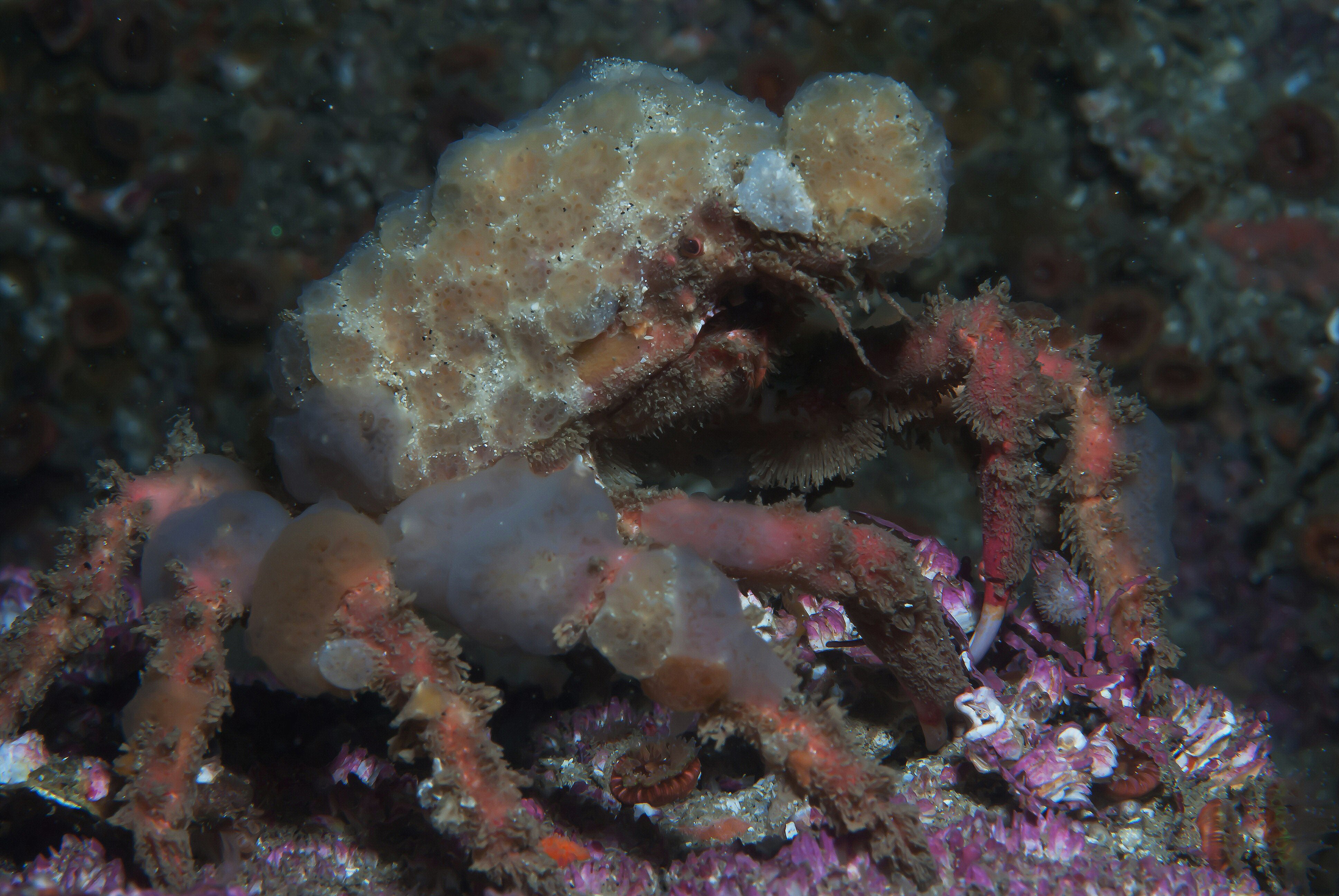
Decorator crab: How could WUaS best design Lego robots for archaeology eg to dig La Brea Tar Pits & re #RealisticVirtualEarth & #RealisticVirtualEarthForArchaeology Google StreetView w TIME SLIDER with drone flight too for video?, 'robots for archaeology digs' - BUILD a Lego Robot, robotics' projects WeDo 2.0 Lego Elevator (Lift) ... Pump ... Wind Mill ... Mine Railway ... In this "LEGO Bits and Bricks-Intro Video" I can see a Harbin warm pool for #RealisticVirtualHarbin #ActualVirtual #PhysicalDigital DIRECT CORRESPONDENCE & re Lego Robotics INTO BRICK STREET VIEW (so Google Street View with TIME SLIDER) at cellular/atomic, Where is UNESCO Heritage Futures @UnescoChairLNU heading with archaeology ... " ... see, too, the day before yesterday's blog post ... Llama: WUaS @WorldUnivAndSch is still after 10 yrs 'underground'
- https://scott-macleod.blogspot.com/2018/09/decorator-crab-how-could-wuas-best.html -
*

...


No comments:
Post a Comment